Gion Festival's illustrated digital map returns for 2026
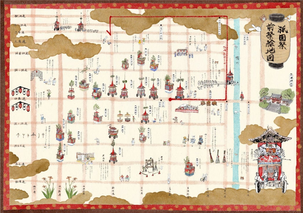
Gion Festival's illustrated digital map returns for 2026
On July 13, 2026, Stroly announced a seventh-year collaboration with Kyoto Shimbun: an illustrated digital map for Gion Festival, released in time for the festival season that runs from July 1 to July 31. The map is titled Gion Matsuri Ezu, and it is designed to help visitors follow the festival's float districts, ritual calendar, and neighborhood-level landmarks without losing the atmosphere of the event itself.
The project is still recognizably rooted in local publishing and local knowledge. Kyoto-based illustrator Yuka Mori drew the map by hand, using a playful style that echoes Chojugiga-inspired line work while keeping the festival's visual identity readable. That balance matters: the result is not a generic tourist map, but a guide that tries to carry the feeling of Gion Festival with it.
What Was Announced
The release covers the 2026 edition of the illustrated map and keeps the core idea that made the collaboration useful in previous years. Users can switch between the front-festival and back-festival versions, check their current location through GPS, and open spot pages that include explanations of the floats, related rituals, and background details. The map also supports Japanese, English, and Korean, which makes it more practical for international visitors who want to explore Kyoto during the festival rather than just read about it afterward.
According to the release and the map page, the digital map also links to related YouTube videos and panoramic images at selected spots. That gives it a different role from a paper brochure: it can work as a live companion while walking the streets, or as a reference guide for someone planning a visit from abroad.
Important note: the map is not a substitute for a formal festival handbook, but it is a useful way to make the events easier to follow. It focuses on the festival's floats, neighborhoods, and related rituals rather than trying to explain Gion Festival from scratch.
Why It Matters
Gion Festival is one of Japan's three great festivals and one of the country's most recognizable summer traditions. It has more than a thousand years of history, runs across the full month of July, and reaches its high point with the yamaboko processions on July 17 and July 24. For international readers, that scale can be hard to parse at first: there are float districts, preview nights, rituals, and a festival rhythm that changes by date and neighborhood.
This is where the digital map earns its value. It does not replace the festival experience; it lowers the barrier to entering it. A multilingual, GPS-linked map gives first-time visitors a cleaner starting point, and it gives returning visitors a way to plan a route without losing sight of the cultural details that make the festival distinct.
Context for International Fans
Gion Festival is closely tied to Kyoto's identity, but it is also one of the easiest Japanese traditional events for overseas travelers to encounter in a meaningful way. The festival is held around Yasaka Shrine, the procession floats are a signature visual, and the event has been recognized as UNESCO Intangible Cultural Heritage. The illustrated map turns those facts into something navigable: it translates a large, living festival into a tool people can actually use on the street.
That approach is especially appealing to anime and manga readers who already appreciate drawn worlds and location-based storytelling. Even though this project is not anime-linked in the narrow sense, it shares a similar strength: visual storytelling that helps you understand a place faster than a plain text guide can.
What Happens Next
The map is already live, so the immediate next step is simple: use it while the festival is still underway. Gion Festival continues through July 31, 2026, and the map page says the main procession information and GPS-linked browsing are available now. If you are planning a trip to Kyoto this month, the illustrated map is a practical starting point before you decide which float district or ritual to visit.
Sources
- PR TIMES press release: Kyoto Shimbun and Stroly collaborate on the 7th Gion Festival illustrated map
- Stroly map page: Gion Festival illustrated digital map 2026
Information was checked on 2026-07-14 19:22 JST.


Comments
Post a Comment